The most recurrent error in Basingstoke is copying a standard strip footing schedule from a Southampton or Reading project. It fails here. The Cretaceous chalk beneath the town is not a uniform rock mass. It contains dissolution pipes, soft putty zones, and an irregular mantle of clay-with-flints that can change thickness by two metres within a single plot. A desk study alone cannot detect these features. Intrusive investigation combined with a design methodology that treats the chalk in accordance with CIRIA C574 guidelines is the only way to avoid differential settlement that shows up as cracking within the first two wet-dry cycles. Before the trial pits go in, we often correlate nearby borehole logs with a seismic refraction survey to map the top-of-chalk profile, which is critical when the clay-with-flints layer masks the true rockhead depth.
Bearing capacity in Basingstoke chalk is not a single value. It is a function of the chalk grade, the confining stress, and the water regime at the foundation level.
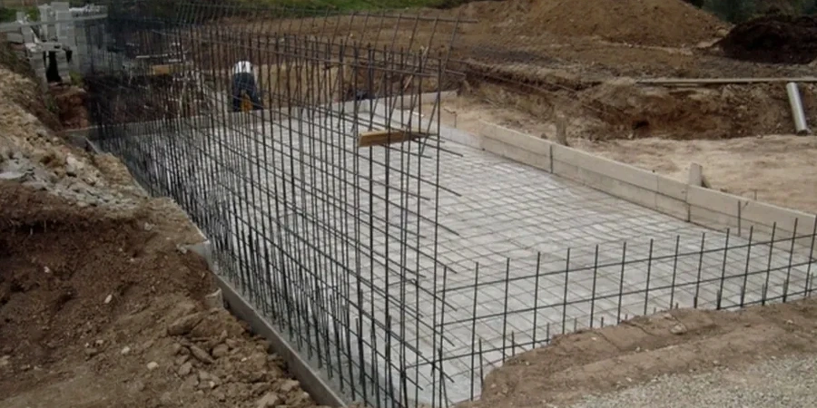
Our approach and scope
Local considerations
The soil profile north of the M3 around Chineham is markedly different from the town centre. Chineham sits on thicker Eocene London Clay outliers, while the town centre and the southern suburbs like Brighton Hill are directly over the chalk with a thin clay-with-flints cap. This means a shallow foundation designed for the chalk at Brighton Hill — where dissolution features pose a collapse risk — will be completely wrong for the shrinkable clay in Chineham. The clay undergoes seasonal volume change that demands a minimum foundation depth of one metre, per NHBC Standards Chapter 4.2. Overlooking the transition zone between these two geological units is the most common cause of foundation-related claims in the Basingstoke area. The design must include a geological model that traces the London Clay feather edge across the site.
Relevant standards
The design shall reference BS EN 1997-1:2004 (Eurocode 7: Geotechnical design – General rules), BS 5930:2015 (Code of practice for ground investigations), CIRIA C574 (Engineering in chalk), and NHBC Standards 2024, Chapter 4.2 (Building near trees).
Other technical services
Bearing Capacity and Settlement Verification
Analytical and numerical bearing capacity assessment for strip, pad, and raft foundations on chalk and residual soils. Settlement calculations use a stress-dependent stiffness model for structured chalk, calibrated against in-situ test data.
Foundation Design Package for Building Control
Dimensioned drawings and calculation reports for submission to Basingstoke and Deane Borough Council Building Control. Includes the geotechnical design report, structural foundation layout, and construction specification notes.
Typical parameters
Questions and answers
What is the typical cost for a shallow foundation design for a residential extension in Basingstoke?
For a single-storey rear extension on a chalk-bearing stratum, the design package, including a site visit, interpretive report, and bearing capacity calculation, falls between £1,480 and £2,340. The final figure depends on whether a trial pit investigation is already available or must be commissioned.
How deep do footings need to be in Basingstoke chalk to avoid frost heave?
The minimum depth to underside of footing is 450 mm below finished ground level for frost protection. However, on clay-with-flints sites, the NHBC minimum of 900 mm to 1,000 mm applies if trees are nearby. On chalk, the controlling factor is often the penetration through the weathered mantle into competent Grade A or B chalk.
Can a raft foundation be used on the clay-with-flints in Basingstoke instead of deep trench fill?
Yes. A stiffened raft is a practical alternative when the clay-with-flints is thicker than 1.5 metres and strip footing trenches would be uneconomical. The raft design requires a compressibility index from an oedometer test and a swelling pressure assessment to size the internal beams correctly.